4-26-09
After a long day
at Swakane Canyon the day before, Kim wanted to get out again. My sore
knee was not feeling too bad Sunday morning so I joined her. Downhills
are what is hurting my knee so we planned a few river walks with little
elevation change. I had never been on the Beaver Lake Trail. I had done
part of the Old Sauk from the south end but that was nearly 20 years
ago. Much of the trail I walked has since fallen into the
Sauk River. The trail keeps getting rebuilt farther inland.
We had an unusually late start, not leaving Seattle until 9:00 am. Driving by Mt. Higgins we stopped along the NF Stillaguamish River. Kim knows all the good spots to view the river. We drove into Darrington then south on the Mountain Loop Highway (MLH) to the White Chuck River. Last year we drove over Gold Mountain to reach the White Chuck Bench Trail. Since then the new bridge to the boat launch is in place. We drove across so I could see the new bridge. Just opposite the bridge on the west side of the MLH is the trailhead for Beaver Lake.
Kim explained that there are no longer any beavers and the lake is really just a marshy area now. The trail follows the Sauk River. It is only about 1 1/2 miles to the "lake". So short I never took the time to visit. The trail is full of old trees, moss, and has skunk cabbage in the spring. We timed it perfectly. The route is along an old railroad grade. The river is nearby on the right and the left is lower than the grade. The result is lots of water on the left side. This is perfect for the proliferation of skunk cabbage. The began early and kept on going.
We took one detour to the gaging station and a small sandy beach along the river. A few steps off the grade and the moss covered everything. We saw a few trillium here. That was another hallmark of this day. We also saw violets and bleeding hearts. Lots to photograph so we made very slow progress. Kim mentioned several washouts. We came to a big one and I didn't like the drop to river level but decided to give it a go. My knee was not very happy but it was not too bad. The route now sidehills just above river then climbs steeply back to the grade.
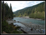
Buried several feet deep were the old railroad rails, now partly exposed and hanging in mid air. Neat to see some of the history revealed. We continued to another washout. This one created an opening looking down the river and up to Bedal and Sloan Peaks. Kim said the view was not there until the forest fell into the river. The route went inland around the washout but where it again dropped to river level I called it quits. I'm trying not to mess up my knee more before it can heal. We went back to the start of this washout and stopped for lunch. We had hiked about one mile and it was already after 1:00 pm.
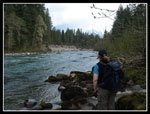
The lunch spot was great. The river flowed by and the peaks came in and out of the clouds. Across the river the trees were leafing out in varying shades of green. A really pretty spot. Another group came by and continued on to the lake. As we were packing up another group came by. The boy was about 12 and the woman was likely his grandmother. She had a polished wooden hiking staff and another pole. She mentioned her bad hips and wanted to know if the trail became difficult. Kim and I did a double take. She had already crossed the first washout, side hilling on loose dirt just above the roaring river. Then she had to climb up a 6 feet step with no hand holds. I'm 6' 4" and had a tough time. Grandma wanted to know if this gentle trail ever got hard. We figured she was scoping out Sloan Peak for a morning jaunt on Monday.
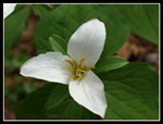
On the way back Kim ran into an old friend from trail maintenance trips. I'm never surprised when she runs into someone she knows on a trail in this area. With two whole miles in the book we headed on to trip number two. A short drive down the MLH brought us to the north trailhead of the Old Sauk Trail. This lot had half a dozen cars or more. The first thing we noticed was the lack of flowers. Soon we saw trillium. Then came the violets and bleeding hearts. In fact, I have never seen so many trillium on any trail ever. There were singles then doubles then triples and even clumps of five, six, or seven. They all seemed to be right near their peak.
The trail is usually near the river. At first it is near a wide dry channel. The real river is far away. During the 100 week floods of 2003 and 2006 the river filled an amazingly wide swath. Even during the spring snow thaw it's just a fraction of it's flood size. In places we could see parts of the old trail that would disappear over the edge where it had washed away. The trail is in very good shape. A little mud but generally dry and logged out.
This trail is moss covered from end to end. It covers the ground and stumps and hangs from the trees. In places it gets even more impressive. A true temperate rain forest. We hiked about 2 1/2 miles getting near to the south end. We stopped at another viewpoint along the river. Kim pointed out a place where the bank on the opposite side had collapsed. A big white cliff is there now. Coincidently, or not, on this side of the river the area above and inland of the river is silt covered. Did it come from the big washout across and upstream?
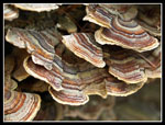
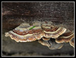
On the way back Kim pointed out a log covered in turkey tail fungus. The semi circle shape looks like a turkey's tail. The colors are amazing. Red, blue, orange, and many more. I don't recall ever seeing such a bright blue in nature. The hike back was much faster. My knee was feeling it and I sped up to get the last mile done. There were no summits to reach this day. No lakes either. Still, a couple river walks in mossy forest with lots of spring wildflowers was a treat. Kim has done these trails many times and I can see why.
Kim's report and photos are here: Nwhikers Report
Trips - 2009
Home


