3-28-09
Winter storm
warning, high
winds with snow, and considerable avalanche danger. What's a hiker to
do? With both my cars out of commission I was dependent on someone else
to drive. Kim let me choose the destination and I pulled out a snowshoe
trip I had been contemplating for a number of years. The NF
Teanaway Road has only been plowed to the end of pavement for about ten
years. Previously it was too far from the Lick Creek lot to go far up
the valley. Now there are a number of options. In the summer I have
hiked the old road up Standup Creek to the end just below an old
lookout site. From the Standup Creek Trailhead its only about a mile. A
nice choice for after a day up the Standup Trail. From 29 Pines CG in
winter it's a fun day snowshoe trip.
We were out of Seattle by 7:15. There was some rain and snow but we were ahead of the storm. We stopped for gas and it was 9:30 by the time we reached the parking area. There were already at least half a dozen snowmobile trailers there. Two snowmobilers passed us near the start. They were the only ones we saw until the end of the day. The road is groomed for snowmobiles and so was hard packed making for easy walking. Walking the road allows for time to see things that are missed at 35 mph in a car. We saw a couple of beaver dams between the road and the river. We also took a short detour over to the river.
The Stafford Creek junction comes up in about 1 1/4 miles. The grooming is on the main road and we turned right onto the Stafford Creek Road. There were old snowshoe tracks. With the cold temperature we were able to keep our snowshoes on our packs. I expected the snowshoe crowd would continue down the main road. At the Standup Creek Road I was in for a surprise. The tracks headed up Standup Creek. That junction is at about 2 miles. The tracks were still well enough consolidated to allow for boots only.
The right side of the road had signs for a forest cut. I'm not sure if the logging is coming soon. For some reason there are blue ribbons hanging from trees about every 25 feet. All the way up the road. Very strange. There is one spot where a washout come done the hillside. I didn't even notice it coming in but it was obvious going out. It's not huge but I'm not sure if a car can get through without it being regraded. Although snow covered it looks like about a two foot drop on one side.
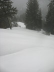
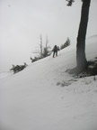
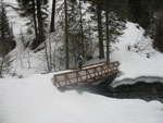
At the Standup trailhead we found the bridge has snow up to the top of the handrails. The top is packed down flat so it's not hard to walk across. The snowshoe tracks seemed to end and ski tracks headed up the Standup Trail. After a food break it was time to put on snowshoes. Without the tracks I was postholing. Three miles down and one to go. The Standup Road is a steady uphill grade but never steep. It looked like there was one set of ski tracks heading up the road but it was old and almost invisible.
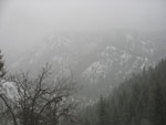
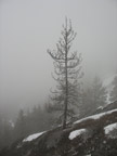
Light snow began early in the trip and it grew heavier as we proceeded. There was one tree down across the road. It has lots of branches and we squeezed through. We ascended into the clouds and visibility out was minimal. Near the top we passed a single larch tree right along the road. The road ended right above the Stafford Road. We walked one mile in and another mile right back again. I recalled a short trail to the lookout site. It looks a bit different in the winter.
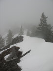
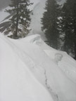
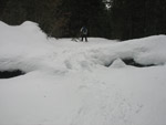
I found the start of the trail but it was quickly under snow. The snow was hard but with snowshoe's we headed straight up. It sure seemed a lot steeper with the hard snow than it did on a dirt trail. I reached the top to find visibility measured in feet not miles. It was neat with the misty ridge and falling snow. The predicted wind never did get there. Instead of a minute on the summit we were able to sit down a little below the top and have lunch. After 4 miles of walking we were about 1 1/2 miles from the car in a straight line.
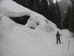
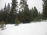
The trip down was much faster. We kept snowshoes on all the way to the NF Teanaway Road. The snow was softer than in the morning. Walking along the Stafford Road we noticed all the tall deciduous trees mixed in with evergreens. That along with the snow lined creek was beautiful. Back at the main road we took off snowshoes and hoofed it out. The groomed road was still very hard. With a quarter mile to go we met a family of three with two dogs enjoying a hike. They were the only people we saw other than the two snowmobilers at the start. At the end the snow was coming down harder than ever.
The drive home was not too bad. Light traffic and mostly bare pavement. It did snow much of the way, especially west of Snoqualmie Pass. We did not get the "several feet" of snow at the upper end of the forecast. This was a good trip. Eight miles round trip with about 1400' of gain. Almost zero people. Falling snow rather than rain. An excellent trip to a view (on a clear day) with an easy route up to the last 100'. A good trip on a winter storm warning day.
Trips - 2009
Home


