6-21-14
I
have wanted to again hike up the Standup Creek Trail to Earl Peak for
quite a few years. On my last visit in 2007 we took a long time with
photography and when on the ridge the wind was howling. We turned
around about a third of a mile before the top of Earl Peak. That
trip included Karen Sykes. At
the end of this day we received the news that she passed away in Mt
Rainier National Park. A very somber finish to a great day hike. Gwen
joined me and we met in Bellevue at 7:00 am. We headed east to Cle Elum
then up Highway 970 to the Teanaway River Road. One mile beyond the end
of pavement we went right on the Stafford Creek Road. Just as rocky as
ever. Left on the Standup Creek Road to the trailhead. That road was
fine with a Subaru. Most cars could make it though there are a few deep
drain dips to cross. We reached the trailhead at about 8:55 am. By 9:10
we were on our way. There were already two vehicles ahead of us. Two
hikers left a few minutes before us.
The morning was cool but not cold. Shorts and short sleeves were fine from the start. We had blue sky at first though it turned white as the day went on. The trail starts on an old road. There are six creek crossings to the trail junction beneath Earl Peak. One more heading to the ridge on the Standup Creek Trail. We went up Standup and down the Bean Creek Trail and had 13 total crossings on the day. They can be challenging early in the year. There was plenty of water even in mid June though we managed all the crossings with dry feet. The first crossing, as well as several others, had very slick rocks to cross on. After the first crossing the trail begins to narrow. Lower down there were some spots that were a little brushy.
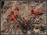
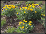
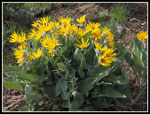
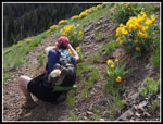
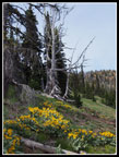
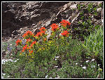
The wildflower show began at the start and continued most all the way up. Not overwhelming but a good variety of colors. Trillium down low were done or purple. Higher we found some still in bloom. Lots of vanilla leaf in bloom, queen's cup too. There were many columbine in bloom and some past prime. There were some arnica in bloom but no balsamroot for most of the trip. Near the Standup - Bean Creek junction there was a ton of balsamroot right at the peak. Indian paintbrush was in orange, red, yellow, and salmon colors. We even had some lupine. The western anemone covered the ground on the Standup Ridge below Earl. A much better flower display than I was expecting.
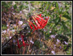
There were about a dozen trees down across the trail. Several required detours around and some a big step to get across them. Annoying but not too difficult to get around. The trail is a little brushy, as mentioned earlier. Not a problem on a dry day. A little brushing would be nice though this trail does not get enough use to warrant too much work. We worked our way back and forth across the creek gaining altitude at a gently grade. After the fifth crossing the trail got down to business. We switchbacked higher on before another crossing took us out of forest and into the sunshine on a rocky slope. I had hoped to see some scarlet gilia in bloom here. None on the way up but we did find several clumps on the way down.
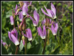
Higher up we could see a big snow patch in the creek below. A lot of snow there but none below and none above until forest near the saddle. We crossed the creek a sixth time and reached meadows of Indian paintbrush and balsamroot. Just before the junction with the Bean Creek Trail the route nears the creek and a whole bunch of blooming shooting stars. At the junction we stopped for sun screen, food, and water. One last creek crossing high on the side of Earl Peak and we went into the forest and picked up the only sustained snow of the day. Gently switchbacks took us up to the near the saddle. Just before reaching it we turned left and headed to the ridge. To this point we had been passed by one couple and a solo hiker. Another couple was just behind us. Those alone are more than all the hikers I haave ever seen on many trips up this trail. Not crowded by any standard except the Standup Trail's normal use.
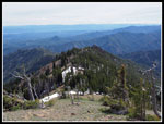
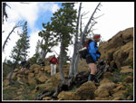
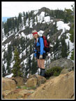
From the ridge we could see down to the Stafford Creek Valley. Across from us was part of the Stuart Range, Navaho Pass, Navaho Peak, one of the Three Brothers, Little Navaho, and Miller Peak. Quite a view. The upper valley was partly snow covered. Now came the best part of the trip. The .70 mile ridge leading to the summit of Earl Peak. The route stays on the ridge top much of the way. In some places it is easier on the left side. In a few places just below on the right side is easier. It is off trail scrambling but not particularly difficult. There was a wealth of wildflowers on the rocky ridge. As mentioned, the western anemone covered the ground. We also saw douglasia, yellow violets, bright red Indian paintbrush, wallflower, and more. We made slow progress and the cameras were always out.
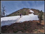
There are a couple false summits along the ridge. Soon we could see people on the summit of Earl. It was not clear if we would have to cross a snow field. On the drive up we saw the SW ridge was bare. There was some snow near the summit. The final scramble to the top was fun. A little rock to ascend then about 30 feet of snow and a few minutes later we were on top. One other couple was left on top. They later left heading towards Navaho Peak before returning via Standup. A very long day. We arrived on top at about 2:05 pm. The sky was white. Not the best for photos. The peaks were all clear of clouds. Not the best but not too bad at all. We had a nice long stay on top. After all, it was the longest day of the year.
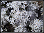
I put on a jacket but it was not very windy and generally pleasant at 7,036'. We did not head down until about 3:25 pm. Our route down was the more usual route from Bean Creek Basin. Right up the SW ridge. The boot path down is on loose gravel much of the way. This ridge too had a nice supply of blooming wildflowers. big bunches of phlox in different colors were most abundant. Several groups were heading up as we came down. at the saddle the signs are all gone. The Bean Creek Trail heading into Standup Creek's drainage was not obvious. We saw it from the ridge above and had no trouble getting to the trail. Near the Standup - Bean Creek junction the balsamroot were wildly colorful and all over the hillside. From the junction we followed our route up. Our loop was complete. We saw no more hikers the rest of the day.
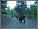
At 6:55 pm we crossed the bridge at the trailhead. A fine day of hiking and scrambling to another Teanaway summit. The drive out had an unexpected twist. It is not unusual to see cows in the NF Teanaway Road. I had never seen a whole herd of them in the road. From the Standup Road junction the next half mile had dozens and dozens of cows in the road. At the worst spot there is a steep slope above the road and a steep slope below. We inched along as Gwen was "herding" the cows with her car. We finally made it through them and sped on to Cle Elum. At dinner we had Internet access and heard the bad news about Karen Sykes. A real disappointment after a great day of hiking.
Trips - 2014
Home


