11-01-14
The
Suiattle River Road washed out 11 miles from the end in 2006. Getting
to the Green Mountain summit then required a 13 mile bike ride gaining
well over 2000' of elevation then a 4 mile hike. 34 total miles round
trip. Understandably, visitation nearly ended. Only a few folks made
the long trek. In 2009
Kim, Randy, and I biked to Downey Creek and hiked the very long
abandoned old lower Green Mt. Trail. It meets the road near the usual
parking lot in just 2+ miles. Four more miles leads to the summit. It
was an adventure finding and following the old trail. In 2012
Gary joined me for another trip up. The first was on snow after leaving
the south facing slope. The second trip in late summer was all on dirt.
In early summer 2014
Kim, Gwen, and I made another trip up. On October 25th the long closed
Suiattle River Road was finally reopened. On November 1st Gwen and I
joined a group for a long awaited day trip up Green Mountain starting
at the new trailhead only four miles from the summit.
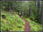
We met at the 164th St Park & Ride in Lynnwood at 6:15 am. We packed into two cards and headed for the Suiattle. The Green Mountain Road was a little muddy in spots but a Subaru had no problems. We arrived at the small 3500' parking lot at 8:30 am. There were already other cars there. By 8:45 am we were on the trail. The trail itself is in good condition. There were two small logs to step over. In the upper meadows the trail slumps a bit but is no problem to hike. There has been a lot of recent rain and I expected the meadows to be soaked. In fact, I did not need rain pants. The brush was not very wet at all.
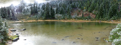
On my two early summer visits since the road was closed the trail was bare through the meadows on the south side. When the route traversed to the north it was instantly covered by snow. This time was similar though with just a thin coating of recent snow. At the high point before dropping to the basin we found our July campsite. It was less flat and brushier than I expected. We had a nice flat meadow with 3+ feet of snow. Dropping down to the tarn the trail was very icy. At the tarn Gwen put on microspikes. Not necessary but a good idea the rest of the way up. It was a cloudy day and at first the lookout was lost in gray and white. As we rose above the tarn we had some views up and could even see the lookout. The weather was looking up. Several other parties caught up with us. Above the tarn the route was mostly covered by an inch or two of snow. higher up the snow was a bit deeper.
The route makes a number of switchbacks before reaching the ridge. It then continues up just below the ridge. On the final ridge climb I met Mid Life Hiker from NWHikers.net. I had met him when I was coming out from Buck Creek Pass in August and his group was coming in. Next I met Janet, Alexi, and Tom coming out. They left an hour before we did. We finally reached the lookout and joined our group and several others. The clouds allowed views of Glacier Peak and other summits earlier in the morning. As I arrived much of the view was gone. I did have a look at the Ptarmigan Traverse peaks for a moment before they were lost in the clouds.
To my surprise there was some sunshine beaming down on us. With almost no wind and sun it was a very comfortable 40 or so degrees at 6500'. The Forest Service's sign that I had struggled to screw in back in July was still firmly in place. After 8 long years everyone was excited to finally be back atop the mountain. A few folks had never been on it before. For others it had been decade or more. I was fortunate to be making my fourth visit in the last five years but by far the easiest one. No heavy overnight backpack and no dozens of big logs to struggle over on the abandoned lower trail. Starting next summer this will again be a very popular trail. The groups this day were getting in a last late season visit before the whole mountain is buried by many feet of snow.
The NWHikers party was far from over. Next Cartman, RichP, and Matt P joined us. Later Opus and Fourteen Four Ten arrived. It was an unplanned NWHikers social on the top of the mountain. The lookout is locked up for now and one side of the walkway around the building is missing. Their was plenty of room on the walkway for many of the visitors. We arrived around noon and stayed for nearly an hour. It was disappointing to have to leave.
On the way down we noticed how much of the thin snow cover had melted. The white slopes were largely brown and green grasses again. We passed Stetattle Boy and Hulksmash coming up. Two more NWHikers friends. The trip down was much faster. Part of our group detoured to climb the small sub summit above the tarn. The rest of us just headed back to the cars. We met several more groups coming up the trail. Near the bottom we met some mushroom pickers. The heavy rains had waterlogged many of the mushrooms but they found a few. The lot was full with more cards parked along the road. A lot of folks were anxious to reacquaint themselves with the wonderful trails along the Suiattle River Road.
For the day we had no rain and even a little sunshine. There were a few views out and just seeing the slopes clad in snow in the morning was very scenic. I met a lot of friends and acquaintances on the mountain. The snow will be falling soon but this was a great late fall trip to a once difficult and now easier to reach favorite trail.
Click on thumbnails to get
larger pictures.
Trips - 2014
Home
We met at the 164th St Park & Ride in Lynnwood at 6:15 am. We packed into two cards and headed for the Suiattle. The Green Mountain Road was a little muddy in spots but a Subaru had no problems. We arrived at the small 3500' parking lot at 8:30 am. There were already other cars there. By 8:45 am we were on the trail. The trail itself is in good condition. There were two small logs to step over. In the upper meadows the trail slumps a bit but is no problem to hike. There has been a lot of recent rain and I expected the meadows to be soaked. In fact, I did not need rain pants. The brush was not very wet at all.
On my two early summer visits since the road was closed the trail was bare through the meadows on the south side. When the route traversed to the north it was instantly covered by snow. This time was similar though with just a thin coating of recent snow. At the high point before dropping to the basin we found our July campsite. It was less flat and brushier than I expected. We had a nice flat meadow with 3+ feet of snow. Dropping down to the tarn the trail was very icy. At the tarn Gwen put on microspikes. Not necessary but a good idea the rest of the way up. It was a cloudy day and at first the lookout was lost in gray and white. As we rose above the tarn we had some views up and could even see the lookout. The weather was looking up. Several other parties caught up with us. Above the tarn the route was mostly covered by an inch or two of snow. higher up the snow was a bit deeper.
The route makes a number of switchbacks before reaching the ridge. It then continues up just below the ridge. On the final ridge climb I met Mid Life Hiker from NWHikers.net. I had met him when I was coming out from Buck Creek Pass in August and his group was coming in. Next I met Janet, Alexi, and Tom coming out. They left an hour before we did. We finally reached the lookout and joined our group and several others. The clouds allowed views of Glacier Peak and other summits earlier in the morning. As I arrived much of the view was gone. I did have a look at the Ptarmigan Traverse peaks for a moment before they were lost in the clouds.
To my surprise there was some sunshine beaming down on us. With almost no wind and sun it was a very comfortable 40 or so degrees at 6500'. The Forest Service's sign that I had struggled to screw in back in July was still firmly in place. After 8 long years everyone was excited to finally be back atop the mountain. A few folks had never been on it before. For others it had been decade or more. I was fortunate to be making my fourth visit in the last five years but by far the easiest one. No heavy overnight backpack and no dozens of big logs to struggle over on the abandoned lower trail. Starting next summer this will again be a very popular trail. The groups this day were getting in a last late season visit before the whole mountain is buried by many feet of snow.
The NWHikers party was far from over. Next Cartman, RichP, and Matt P joined us. Later Opus and Fourteen Four Ten arrived. It was an unplanned NWHikers social on the top of the mountain. The lookout is locked up for now and one side of the walkway around the building is missing. Their was plenty of room on the walkway for many of the visitors. We arrived around noon and stayed for nearly an hour. It was disappointing to have to leave.
On the way down we noticed how much of the thin snow cover had melted. The white slopes were largely brown and green grasses again. We passed Stetattle Boy and Hulksmash coming up. Two more NWHikers friends. The trip down was much faster. Part of our group detoured to climb the small sub summit above the tarn. The rest of us just headed back to the cars. We met several more groups coming up the trail. Near the bottom we met some mushroom pickers. The heavy rains had waterlogged many of the mushrooms but they found a few. The lot was full with more cards parked along the road. A lot of folks were anxious to reacquaint themselves with the wonderful trails along the Suiattle River Road.
For the day we had no rain and even a little sunshine. There were a few views out and just seeing the slopes clad in snow in the morning was very scenic. I met a lot of friends and acquaintances on the mountain. The snow will be falling soon but this was a great late fall trip to a once difficult and now easier to reach favorite trail.
 Green Trail |
 The Tarn In The Meadow |
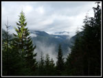
 Suiattle Valley |
Trips - 2014
Home


