11-07-15
Heavy
rain in the northern Cascades. Lighter rain down south. No good place
to go. Gwen joined me for a less visited closer in hike. I first hiked
the trails in the King County Taylor Mountain Park on 11-29-09.
Kim an I did a short 3 mile trip. I came back on 1-09-10
for a longer 9 mile trip. I was really surprised to see that nearly six
years had gone by without a return visit. This one was Gwen's idea. I
was happy to explore more of the park's trails. We met in Bellevue then
headed east. Off I-90 onto Highway 18, over Tiger Summit, and down to
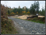
the Hobart exit. A left under the higheay and the parking is quickly on
the left. Gwen heard that the parking lot was under construction.
Indeed it is closed for several more months. In the mean time there is
parking for a dozen or so cars just before the lot. A quick look to the
construction shows a new outhouse. The gravel lot will possibly be
paved as well.
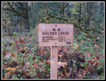
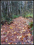
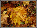
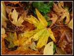
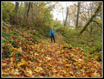
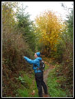
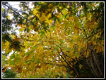
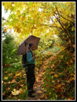
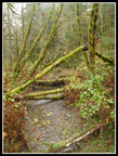
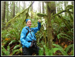
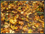
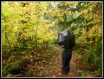
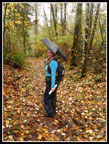
A sign pointed us to trails. We started up the Holder Ridge Trail. It was raining hard at Tiger Summit but it was temporarily dry as we headed out. This whole area was logged and most of the forest is deciduous at this point. That meant lots of leaves. Big maple leaves were all over the ground much of the day. Very thick near the start of our route. Before long the umbrella came out. Though wet it was a warm day, in the low to mid fifties. The trail climbs up in thin forest. I think there were a lot more views in 2009. A very short side trail led to a picnic table. Not the day to sit still long. Little in the way of views though the low dark clouds did not help. On my previous trip I took a photo of downtown Seattle. No signs of it this day.
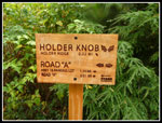
The route descends a bit to cross a small creek then climbs to a junction. From here we made a big loop before retracing the final bit to the car. We turned left and began to climb to the top of Holder Knob. Not much of a climb. The main trail contours around the top but a short side trail goes right to the top and quickly meets the main trail. We headed up. the top is a good sized flat area that is encased in trees and mostly brush. Not much of a view from here. There is another picnic table there. My 2010 photos showed views of Seattle, East Tiger, and Taylor Mountain. Not so much anymore. A few steps north and we were back on the Holder Knob Trail. The trail soon become an old road that is now very grassy. it continues around the Knob and drops down to Road A not far from the Holder Ridge Trail we started on.
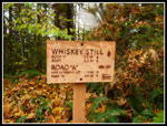
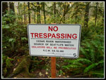
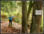
We crossed the road onto the Whiskey Still Trail. From here is was mostly downhill. After .70 miles we turned right onto the Mt. Beaver Trail. There area a lot of short trails and a map is very useful. Most but not all trails are signed. Another .60 miles and we reached the Carey Creek Trail. We turned left and follwed the creek. First we crossed the creek on a bridge. Most crossings have bridges. We soon met the first people of the day. In fact one dog and two folks on horseback. A few minutes later came a long runner with a dog. That was it for the entire day. We saw nobody else. One unique fact about the park is that there are some trails that go into the Cedar River Watershed. You must stay on trail but there is access. The Carey Creek Trail comes to a junction with Road G. SE 208th St. is in sight. With the main parking lot closed construction there were a lot of cars parked along the road here. Road G meets Road A and provides a fast way back to the main parking area where we started.
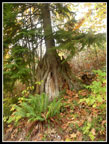
Some of the trails in the park are marked on maps as closed from October 15 - April 15. A short way up Road G is the junction with the Elk Ridge Trail. We expected a sign for the seasonal closure. There was no sign. In fact, none of the seasonal closure trails we passed were signed as closed. On Tiger Mt. they are always signed when closed. With that in mind, the Elk Ridge Trail may be seasonally closed at any time. After many old roads and roads turned trails the Elk Ridge route is a real trail. In places there is evergreen forest. The route climbs slowly and steadily. This is still in the watershed with many signs to stay on trail. Near the high point on the trail we left the watershed. We stopped for a food and water break near the next junction. At about 1300' this was the high point of the trip.
Gwen was in charge of the route and there were a lot of short trails that made up our whole route. We next took the Sherwood Trail for .50 miles to again reach Road A. This is a four way junction and we went across the road and continued on Road F. After only .15 miles The Boot Trail went off on the left. This took us on a half circle back to where we had earlier turned off on the Mt. Beaver Trail. The Boot Trail continues ahead and is now called the Whiskey Still Trail. Soon we were back at Road A where the Holder Knob Trail brought us earlier in the day. A short climb on the Holder Knob trail brought us to the junction with the Holder Ridge Trail. The rest of the way back was on the route we hike up in the morning. If solitude was the goal, we hit the jackpot. A trail so close to the cities should have had at least a few more folks even on a rainy day.
Now for a few comments on Taylor Mountain County Park. It is not deep forest like nearby Squak, Tiger, and Rattlesnake. That is slowly changing however. The open clearcut I hiked through in 2009 is growing up. Over time it will be much better. There are a lot of roads or grassy old roads. A few are graveled and used by park workers to get to places in the park. More are well on their way to becoming trails. The number of trails makes it possible to select a number of different routes. Three miles, six miles, or more than ten miles. The choices are a but smaller when the seasonal trails are closed but there are still plenty of routes that can be cobbled together. My last two trips have covered the majority of routes but there are still a few places for me to explore. Thanks to the generally low elevation most trails will be snow free right through the winter. The map states that there are 30 miles of trails in the park.
For the day we hiked about 10 miles with 1700' of gain. Not bad when the low point was 500' and the high point was only 1300'. I expect I will get back here a little more often in the future.
Here is a link to the pdf map of the trails: Taylor Mountain Map
Click on thumbnails to get
larger pictures.
Trips - 2015
Home
A sign pointed us to trails. We started up the Holder Ridge Trail. It was raining hard at Tiger Summit but it was temporarily dry as we headed out. This whole area was logged and most of the forest is deciduous at this point. That meant lots of leaves. Big maple leaves were all over the ground much of the day. Very thick near the start of our route. Before long the umbrella came out. Though wet it was a warm day, in the low to mid fifties. The trail climbs up in thin forest. I think there were a lot more views in 2009. A very short side trail led to a picnic table. Not the day to sit still long. Little in the way of views though the low dark clouds did not help. On my previous trip I took a photo of downtown Seattle. No signs of it this day.
The route descends a bit to cross a small creek then climbs to a junction. From here we made a big loop before retracing the final bit to the car. We turned left and began to climb to the top of Holder Knob. Not much of a climb. The main trail contours around the top but a short side trail goes right to the top and quickly meets the main trail. We headed up. the top is a good sized flat area that is encased in trees and mostly brush. Not much of a view from here. There is another picnic table there. My 2010 photos showed views of Seattle, East Tiger, and Taylor Mountain. Not so much anymore. A few steps north and we were back on the Holder Knob Trail. The trail soon become an old road that is now very grassy. it continues around the Knob and drops down to Road A not far from the Holder Ridge Trail we started on.
We crossed the road onto the Whiskey Still Trail. From here is was mostly downhill. After .70 miles we turned right onto the Mt. Beaver Trail. There area a lot of short trails and a map is very useful. Most but not all trails are signed. Another .60 miles and we reached the Carey Creek Trail. We turned left and follwed the creek. First we crossed the creek on a bridge. Most crossings have bridges. We soon met the first people of the day. In fact one dog and two folks on horseback. A few minutes later came a long runner with a dog. That was it for the entire day. We saw nobody else. One unique fact about the park is that there are some trails that go into the Cedar River Watershed. You must stay on trail but there is access. The Carey Creek Trail comes to a junction with Road G. SE 208th St. is in sight. With the main parking lot closed construction there were a lot of cars parked along the road here. Road G meets Road A and provides a fast way back to the main parking area where we started.
Some of the trails in the park are marked on maps as closed from October 15 - April 15. A short way up Road G is the junction with the Elk Ridge Trail. We expected a sign for the seasonal closure. There was no sign. In fact, none of the seasonal closure trails we passed were signed as closed. On Tiger Mt. they are always signed when closed. With that in mind, the Elk Ridge Trail may be seasonally closed at any time. After many old roads and roads turned trails the Elk Ridge route is a real trail. In places there is evergreen forest. The route climbs slowly and steadily. This is still in the watershed with many signs to stay on trail. Near the high point on the trail we left the watershed. We stopped for a food and water break near the next junction. At about 1300' this was the high point of the trip.
Gwen was in charge of the route and there were a lot of short trails that made up our whole route. We next took the Sherwood Trail for .50 miles to again reach Road A. This is a four way junction and we went across the road and continued on Road F. After only .15 miles The Boot Trail went off on the left. This took us on a half circle back to where we had earlier turned off on the Mt. Beaver Trail. The Boot Trail continues ahead and is now called the Whiskey Still Trail. Soon we were back at Road A where the Holder Knob Trail brought us earlier in the day. A short climb on the Holder Knob trail brought us to the junction with the Holder Ridge Trail. The rest of the way back was on the route we hike up in the morning. If solitude was the goal, we hit the jackpot. A trail so close to the cities should have had at least a few more folks even on a rainy day.
Now for a few comments on Taylor Mountain County Park. It is not deep forest like nearby Squak, Tiger, and Rattlesnake. That is slowly changing however. The open clearcut I hiked through in 2009 is growing up. Over time it will be much better. There are a lot of roads or grassy old roads. A few are graveled and used by park workers to get to places in the park. More are well on their way to becoming trails. The number of trails makes it possible to select a number of different routes. Three miles, six miles, or more than ten miles. The choices are a but smaller when the seasonal trails are closed but there are still plenty of routes that can be cobbled together. My last two trips have covered the majority of routes but there are still a few places for me to explore. Thanks to the generally low elevation most trails will be snow free right through the winter. The map states that there are 30 miles of trails in the park.
For the day we hiked about 10 miles with 1700' of gain. Not bad when the low point was 500' and the high point was only 1300'. I expect I will get back here a little more often in the future.
Here is a link to the pdf map of the trails: Taylor Mountain Map
 Parking Lot Construction |
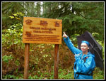
 Good Signage |
 Lots Of Leaves |
 Nice Colors |
 More Leaf Color |
 Gwen On Leafy Trail |
 Nurse Stump |
 What's The Point |
 Overhead Leaves |
 Rainy Day Hiker |
 Trail Junction |
 Whiskey Still Trail |
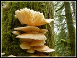 Fungus On Tree |
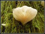 Translucent |
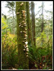 Lots Of Fungus |
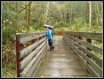 Bridge Over Carey Creek |
 Mossy Trees |
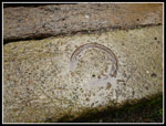 Horseshoe |
 SE 208th Entrance |
 Watershed Boundary |
 Skeleton |
 More Leaf Color |
 Legal Trespassing? |
 Rainy Color |
 Rainy Hiker Girl |
Trips - 2015
Home