03-05-22
I
hiked Thursday night with the group and had a hike planned for Sunday.
I needed a short drive and an easier hike for Saturday. I did not want
a snow slog but I did want to get in some elevation gain. My choice was
a hike I had not done in quite a few years. Added to it was a chance to
check out a new trail. I ran into the partly built trail back in 2020.
Now I knew where it begins. I decided to do it clockwise. This would be
a true loop, starting and ending in the same place with no trail
repeated. The morning was overcast but was supposed to clear up later
in the day. I headed out I-90, turning onto Highway 18 and up to Tiger
Summit. I went on tot he inner parking lot where a Discover Pass is
required. I was a bit surprised to find the parking lot about half full
at a few minutes before 8:00 am. I was on my way at 8:04 am. It was
cool enough for light gloves but warm enough at 40 degrees for just a
baseball cap.
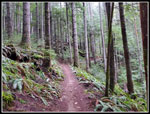
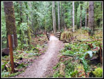
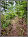
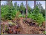
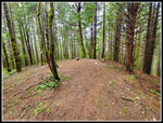
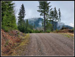
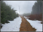
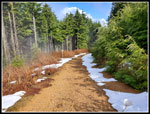
I used to hike the Iverson Railroad Trail back before mountain bikes were popular. Since they have become very popular on this side of Tiger I tent to avoid it. Also it does not have much elevation gain. Most of my trips from Tiger Summit head up East Tiger Mountain. This day I was planning a loop over Middle Tiger with a possibler side trip up East Tiger. I had learned that the Side Hustle Trail had recently opened. It was a one way downhill bike trail. Some hikers mentioned hiking up it. I was not sure about what I could or could not hike. That was a reason for checking it out. With the Side Hustle Trail being one way downhill I did not expect to see many bikers on the Iverson Trail in the morning. I was right. There has been recent logging along the Iverson. The trail itself has not been logged but the east side has been. I saw a photo of a view of Mt. Rainier from the trail. It was too cloudy to see it this day. I passed two hikers heading outbound on the Iverson. At abut 1.3 miles I reached a junction. The Iverson drops down to a main road. The new Side Hustle heads right and uphill. It is a nice trail. I saw a pair of bikers coming down. Easy to step off the trail.
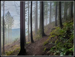
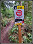
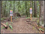
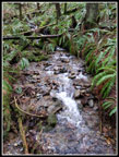
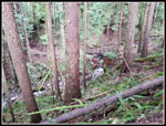
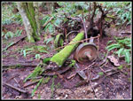
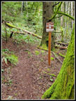
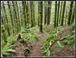
The route runs parallel to a creek in a gorge. The creek rises and the trail crosses it on a big bridge. At the far end is another junction. The Side Hustle is downhill bikes only beyond this point. The new TMT Connector trail heads off to the left. This trail is in forest and in a clearcut that is growing back fast. No bikes allowed on this trail. The route reaches a point where I saw it on my 2020 trip. I guessed then that it probably headed down to the Iverson and I was right. On that trip I explored farther east and ran into what is now the bike only Side Hustle Trail. The TMT Connector dropped down to cross Holder Creek on a new bridge at the site of a train wreck some 97 years ago. In 2020 forms were in place for the bridge foundation. Now it is completed and open. After crossing the railroad wreck site I reached the Tiger Mountain Trail (TMT). I turned right and headed up the TMT. It was not until I returned home that I figured out that the TMT from the wreck site to near the Middle Tiger Trail was all new trail. The old trail through a clearcut crossed a big logging road. I kept waiting for it and it never happened.
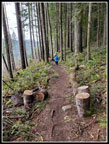
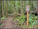
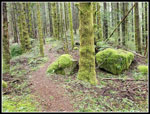
The new section of the TMT is nicely built and much shorter. It goes straight north instead of going around a small highpoint. I reached the Middle Tiger Trail and headed right and steeply uphill. Many volunteer built trail from 30-40 years ago were short and steep. Newer trails take long switchbacks instead of heading right up the slope. This trail had a couple switchbacks but is much steeper than most Tiger Mountain trails. I reached the 2607' top of Middle Tiger and took a food and water break. The new trail section have cut the distance down to 3.50 miles from Tiger Summit. The summit is completely forested with no views. I can still recall back in the late 1980 when there was a good view from the top.
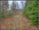
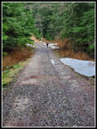
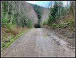
I soon packed up and headed down the other side of the peak. The short steep trail brought me down to a road. The wooden hiker gate has long been bypassed. The reason is anyone over about 80 lbs will not fit through the gate. What were they thinking? The road can bet a bit brushy but in winter with no leaves it was wide and easy. It looks like it has been brushed out recently. Long ago there was a trail over to the main Tiger road but logging put in this road and obliterated the old trail. The road drops a bit then climbs up to the main road. I had a view across to towers on Tiger 1 thought they were mostly in the clouds. I turned right on the big wide logging road and headed uphill. The road tops out and begins a gentle descent. Along here a trail heads left. It quickly splits. The lower trail is the Preston Trail. The upper is the East Tiger Trail heading for the summit. It is very narrow in places on a steep slope and I usually stay away from it. If I was going to do East Tiger it would be by road on a longer route. There were 4 or 5 cars with folks heading out to do trail work.
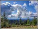
The trail dropped down to a junction. Right 2.8 miles back to my car for an 8 mile day. Left and a 1.2 mile climb with about 600' of elevation gain to the top of East Tiger. I still felt pretty good so I chose to head uphill. I finally saw a few other folks on this leg. I was still in clouds wondering if I would get any sunshine this day. We head heavy snow followed by heavy rain the past 10 days. I did not know if there would be any snow up high. I brought microspikes just in case. I did see snow up by the top but the middle of the road was bare all the way up. No traction devices needed. I reached the summit at 10:54 am. Clouds blocked all the views. No Mt. Rainier view this day. There were half a dozen bikers at the top. I had a little food and water and soon was on my way down. As I prepared to leave the sun came out. It was still quite cool but it felt much warmer the sun. There were still a lot of clouds but we sun overhead. I made much better time going down. I still had 3.9 miles to go. I took a short stop at the viewpoint lower on the summit spur road. I could see South Tiger Mountain but nothing more. From there it was non stop to the bottom. I saw a number of bike groups coming up and a few heading down. The road is so wide it is no problem passing folks.
I reached the bottom at 12:16 pm. I took 4:12 to hike 10.3 miles with 2300' of elevation gain. The trails were all smooth and easily graded except for the trail up and down Middle Tiger Mountain. Coming down the clouds again blocked the sunshine and it was still a cool day at the bottom. On the drive home by car registered up to 54 degrees outside and it was 50 and sunny back in North Seattle. This day provided just what I had hoped for. I hiked another new trail sections. Actually two of them as the TMT was different as well as the new Side Hustle Trail. I had a lot of solitude for much of the trip. As expected the parking lots were all full when I finished my hike. On the short drive back to the highway I passed 3 more cars coming in. It was a fun day on the trail both old and new.
Click on thumbnails to get
larger pictures.
Trips - 2022
Home
I used to hike the Iverson Railroad Trail back before mountain bikes were popular. Since they have become very popular on this side of Tiger I tent to avoid it. Also it does not have much elevation gain. Most of my trips from Tiger Summit head up East Tiger Mountain. This day I was planning a loop over Middle Tiger with a possibler side trip up East Tiger. I had learned that the Side Hustle Trail had recently opened. It was a one way downhill bike trail. Some hikers mentioned hiking up it. I was not sure about what I could or could not hike. That was a reason for checking it out. With the Side Hustle Trail being one way downhill I did not expect to see many bikers on the Iverson Trail in the morning. I was right. There has been recent logging along the Iverson. The trail itself has not been logged but the east side has been. I saw a photo of a view of Mt. Rainier from the trail. It was too cloudy to see it this day. I passed two hikers heading outbound on the Iverson. At abut 1.3 miles I reached a junction. The Iverson drops down to a main road. The new Side Hustle heads right and uphill. It is a nice trail. I saw a pair of bikers coming down. Easy to step off the trail.
The route runs parallel to a creek in a gorge. The creek rises and the trail crosses it on a big bridge. At the far end is another junction. The Side Hustle is downhill bikes only beyond this point. The new TMT Connector trail heads off to the left. This trail is in forest and in a clearcut that is growing back fast. No bikes allowed on this trail. The route reaches a point where I saw it on my 2020 trip. I guessed then that it probably headed down to the Iverson and I was right. On that trip I explored farther east and ran into what is now the bike only Side Hustle Trail. The TMT Connector dropped down to cross Holder Creek on a new bridge at the site of a train wreck some 97 years ago. In 2020 forms were in place for the bridge foundation. Now it is completed and open. After crossing the railroad wreck site I reached the Tiger Mountain Trail (TMT). I turned right and headed up the TMT. It was not until I returned home that I figured out that the TMT from the wreck site to near the Middle Tiger Trail was all new trail. The old trail through a clearcut crossed a big logging road. I kept waiting for it and it never happened.
The new section of the TMT is nicely built and much shorter. It goes straight north instead of going around a small highpoint. I reached the Middle Tiger Trail and headed right and steeply uphill. Many volunteer built trail from 30-40 years ago were short and steep. Newer trails take long switchbacks instead of heading right up the slope. This trail had a couple switchbacks but is much steeper than most Tiger Mountain trails. I reached the 2607' top of Middle Tiger and took a food and water break. The new trail section have cut the distance down to 3.50 miles from Tiger Summit. The summit is completely forested with no views. I can still recall back in the late 1980 when there was a good view from the top.
I soon packed up and headed down the other side of the peak. The short steep trail brought me down to a road. The wooden hiker gate has long been bypassed. The reason is anyone over about 80 lbs will not fit through the gate. What were they thinking? The road can bet a bit brushy but in winter with no leaves it was wide and easy. It looks like it has been brushed out recently. Long ago there was a trail over to the main Tiger road but logging put in this road and obliterated the old trail. The road drops a bit then climbs up to the main road. I had a view across to towers on Tiger 1 thought they were mostly in the clouds. I turned right on the big wide logging road and headed uphill. The road tops out and begins a gentle descent. Along here a trail heads left. It quickly splits. The lower trail is the Preston Trail. The upper is the East Tiger Trail heading for the summit. It is very narrow in places on a steep slope and I usually stay away from it. If I was going to do East Tiger it would be by road on a longer route. There were 4 or 5 cars with folks heading out to do trail work.
The trail dropped down to a junction. Right 2.8 miles back to my car for an 8 mile day. Left and a 1.2 mile climb with about 600' of elevation gain to the top of East Tiger. I still felt pretty good so I chose to head uphill. I finally saw a few other folks on this leg. I was still in clouds wondering if I would get any sunshine this day. We head heavy snow followed by heavy rain the past 10 days. I did not know if there would be any snow up high. I brought microspikes just in case. I did see snow up by the top but the middle of the road was bare all the way up. No traction devices needed. I reached the summit at 10:54 am. Clouds blocked all the views. No Mt. Rainier view this day. There were half a dozen bikers at the top. I had a little food and water and soon was on my way down. As I prepared to leave the sun came out. It was still quite cool but it felt much warmer the sun. There were still a lot of clouds but we sun overhead. I made much better time going down. I still had 3.9 miles to go. I took a short stop at the viewpoint lower on the summit spur road. I could see South Tiger Mountain but nothing more. From there it was non stop to the bottom. I saw a number of bike groups coming up and a few heading down. The road is so wide it is no problem passing folks.
I reached the bottom at 12:16 pm. I took 4:12 to hike 10.3 miles with 2300' of elevation gain. The trails were all smooth and easily graded except for the trail up and down Middle Tiger Mountain. Coming down the clouds again blocked the sunshine and it was still a cool day at the bottom. On the drive home by car registered up to 54 degrees outside and it was 50 and sunny back in North Seattle. This day provided just what I had hoped for. I hiked another new trail sections. Actually two of them as the TMT was different as well as the new Side Hustle Trail. I had a lot of solitude for much of the trip. As expected the parking lots were all full when I finished my hike. On the short drive back to the highway I passed 3 more cars coming in. It was a fun day on the trail both old and new.
 Iverson Trail |
 Misty Forest |
 Hikers Ahead |
 Side Hustle Trail |
 Junction Ahead |
 No Hikers Allowed |
 Hikers Only |
 Creek |
 New Trail |
 New Bridge Below |
 Train Wreck Site |
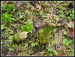
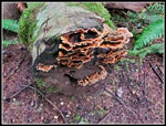 Turkeytail Fungus |
 New TMT Trail Section |
 Middle Tiger Trail |
 Tall Trees |
 Mossy Everything |
 Middle Tiger Summit |
 Heading Down |
 Coltsfoot |
 Road/Trail |
 East Tiger In Sight |
 Skunk Cabbage |
 Top Of Slide Hustle |
 Hiker & Dog |
 Snow Near Summit |
 Sunshine! |
 Neat Clouds |
 On The Road Again |
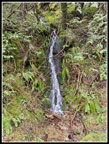 Waterfall |
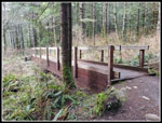 Last Bridge |
Trips - 2022
Home