Day 2
Day 2
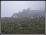
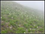
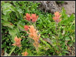
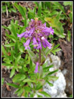
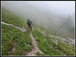
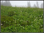
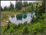
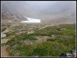
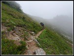
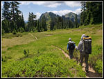
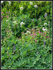
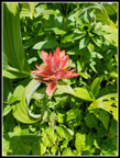
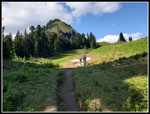
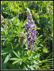
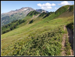
I woke up at 5:40 am and the fog was thick. We were in a cloud. At 6:30 am we were all awake and ready to get up. It was very misty and our tents were covered in condensation in 2012. The sun came out and we let our tents dry before heading out at 10:00 am. This time the condensation was even worse and we decided to pack up wet and hike to Blue Lake for breakfast. We hoped that dropping to the lakes might get us under the clouds. We were on our way right about 8:00 am. We dropped to the trail in thick fog. It continued. We did see a lot of western anemones in the post flowering fuzzy stage. We saw some Indian paintbrush, lousewort, asters, and penstemon as well. There are more ups and downs along the Pilot Ridge Trail. The trail is narrow and could use some work. We passed the turnoff for Johnson Mountain and began the descent to Blue Lakes. Another group went by doing the loop clockwise. We reached the upper lake at 9:33 and found an open campsite for a breakfast break. We were still in the clouds.
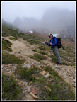
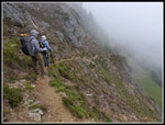
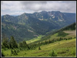
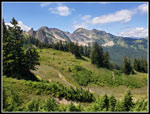
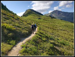
We packed up again and at 10:16 am we headed for the High Route over the ridge and down to the Pacific Crest Trail (PCT). The route is steep. At first the trail is on dirt and easy gaining elevation. Just before the final narrow , rocky, and steep climb to the ridge top we passed a group heading down. Our timing was great as we did not have to pass them on the minimal steep trail above. It seemed that nobody passed us or were passed by us in our direction. All traffic seemed to be in the other direction. I recalled the trail was narrow and steep and that was the case. We had no problems going up. We reached the narrow ridge top at 10:57 am. It was cool and a bit windy on top. We had no views back but it was clearer to the east. There was no point hanging around the top. We quickly headed down. The east side trail is also narrow and steep but mostly just traversed down instead of going straight down the fall line. We watched our footing and traveled slowly on the way down.
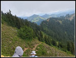
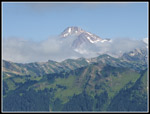
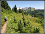
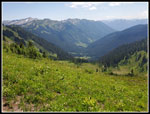
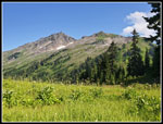
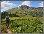
Near the bottom we met the Bald Eagle Trail. It is a longer and less steep route from Blue Lakes. The trail makes a 90 degree right turn as the ridge crossed over to the Cascade Crest ridge. We had our first good views of the day here. We could see a clear Indian Head Peak and a slightly cloudy Glacier Peak. The view was much appreciated after the white out we had at camp in the morning. It was warming rapidly as the clouds gave way to mostly blue sky. At 11:56 am we reached a spot we all remembered from our earlier trips. A grassy meadow with great views. Indian Head Peak looked to be very close. Glacier Peak was less cloudy to the far left. Though we had eaten a late breakfast we had a partial early lunch. At 12:25 pm we headed on. The way over to the PCT was mostly through meadows. There weren't many flowers left but there were lots of shades of green. We arrived at Dishpan Gap on the PCT and kept moving. Now we were heading north east then north and finally northwest to White Pass, our destination for the day.
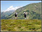
This was still to early for most PCT through hikers to arrive on their way to Canada. This past winter had very heavy snow in the Sierras and many through hikers skipped Sierras and were now in well ahead of schedule. They would have to backtrack to fill in the missing miles after reaching Canada. Later at Red Pass we met several of those people. For this day it was very quiet along the PCT. Fire damage also closed down the eastside trail up through Meander Meadows for the year. That probably added to our solitude. Add in that it was Sunday. A lot of folks were heading home this day. Still, it was very quiet as we saw only a handful of hikes on our way to White Pass. After the crappy trail on the Blue Lakes High Route the PCT seemed like a highway. The grade is always moderate. Our views changed as we hiked north. Kodak Peak was soon in view. We passed the Meander Meadows trail and contoured around Kodak Peak. On the north side we met the route that we took along Poet's Ridge in 2011.
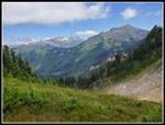
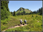
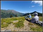
This was a perfect place for another break. We were right next to the boot path up Kodak Peak. It was 1:40 pm. We had great views of White Mountain, the top of Glacier Peak, and a very close Indian Head Peak. On the Poet's Ridge trip linked above, we climbed Indian Head Peak. It was warm but not hot, We seemed to be all alone and camp was in sight. We had no strong urge to get moving. We were also still 5 miles away from camp. There was no guarantee that we would find an open campsite near water in the camp area. Sunday was in our favor but White Pass is on the climber's route up Glacier Peak. Our break lasted until 2:23 pm. We reluctantly put on our packs and started moving. The route is mostly downhill after Kodak Peak. From 5641' it drops to 4960' at Indian Pass. White Pass is at 5930'. That left us about 1000' to gain plus ups and downs. On our previous end of July and start of September trips here we had found a substantial creek not far from our break spot. This year it was not to be. There was just a trickle. We did see a good monkey flower showing at the nearly dry creeks.
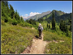
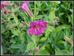
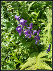
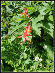
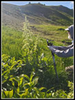
At Indian Creek we were right at the base of Indian Head Peak. One tent was at the pass. A solo hiker heading north passed us. There was a great flower display on our early September trip in 2011. There was not much left at the end of July this year. As we started to climb out of the pass we did see columbine and monkshood in bloom. Columbine I have been seeing nearly every week. Monkshood is seen much less often. The trail climbed moderately by steadily as we contoured around Indian Head Peak. It is a big peak and it took a lot of time. We were now to the east of the peak with views to the south at first and then to the west. Strangely, John noticed bleeding hearts still blooming. I first saw them in mid April this spring. We saw a few tiger lilies, Indian paintbrush, and asters along here. Most asters seen on the trip were beyond peak. These ones were perfect. After passing Indian Head Peak the trail returned to the crest. Sometimes we had views east, sometimes west, and sometimes none while hiking in forest.
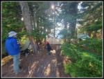
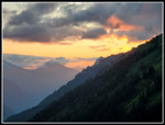
We passed a pond and a slightly larger tarn and even a little remaining snow on the trail. White Mountain came back into view with 1.6 miles to go. This last part seemed to take forever. As we came closer views of Foam Basin came into closer view. That would be part of our loop trip the next day. The slope of the basin looked to be about 80 degrees steep. It is not. We reached White Pass at 5:03 pm. One last 150' drop took us to the camping area. We saw several marmots on the way down. There were quite a few tents in sight but we found a good campsite where we just barely fit all three tents in a band of trees. We hoped to avoid as much condensation as possible. We set up our tents and they did mostly dry off before bedtime. Water was plentiful and we filled two bags with enough for two days. By 8:40 pm we were in bed. It was just a few minutes after sunset and not yet dark. The next day we could look forward to hiking with much lighter packs. For the day we hiked 11 miles with 2700' of elevation gain.
Click
on thumbnails to get
larger pictures.
<< Day >>
Pilot Ridge - NF Sauk Loop Report
Home
I woke up at 5:40 am and the fog was thick. We were in a cloud. At 6:30 am we were all awake and ready to get up. It was very misty and our tents were covered in condensation in 2012. The sun came out and we let our tents dry before heading out at 10:00 am. This time the condensation was even worse and we decided to pack up wet and hike to Blue Lake for breakfast. We hoped that dropping to the lakes might get us under the clouds. We were on our way right about 8:00 am. We dropped to the trail in thick fog. It continued. We did see a lot of western anemones in the post flowering fuzzy stage. We saw some Indian paintbrush, lousewort, asters, and penstemon as well. There are more ups and downs along the Pilot Ridge Trail. The trail is narrow and could use some work. We passed the turnoff for Johnson Mountain and began the descent to Blue Lakes. Another group went by doing the loop clockwise. We reached the upper lake at 9:33 and found an open campsite for a breakfast break. We were still in the clouds.
We packed up again and at 10:16 am we headed for the High Route over the ridge and down to the Pacific Crest Trail (PCT). The route is steep. At first the trail is on dirt and easy gaining elevation. Just before the final narrow , rocky, and steep climb to the ridge top we passed a group heading down. Our timing was great as we did not have to pass them on the minimal steep trail above. It seemed that nobody passed us or were passed by us in our direction. All traffic seemed to be in the other direction. I recalled the trail was narrow and steep and that was the case. We had no problems going up. We reached the narrow ridge top at 10:57 am. It was cool and a bit windy on top. We had no views back but it was clearer to the east. There was no point hanging around the top. We quickly headed down. The east side trail is also narrow and steep but mostly just traversed down instead of going straight down the fall line. We watched our footing and traveled slowly on the way down.
Near the bottom we met the Bald Eagle Trail. It is a longer and less steep route from Blue Lakes. The trail makes a 90 degree right turn as the ridge crossed over to the Cascade Crest ridge. We had our first good views of the day here. We could see a clear Indian Head Peak and a slightly cloudy Glacier Peak. The view was much appreciated after the white out we had at camp in the morning. It was warming rapidly as the clouds gave way to mostly blue sky. At 11:56 am we reached a spot we all remembered from our earlier trips. A grassy meadow with great views. Indian Head Peak looked to be very close. Glacier Peak was less cloudy to the far left. Though we had eaten a late breakfast we had a partial early lunch. At 12:25 pm we headed on. The way over to the PCT was mostly through meadows. There weren't many flowers left but there were lots of shades of green. We arrived at Dishpan Gap on the PCT and kept moving. Now we were heading north east then north and finally northwest to White Pass, our destination for the day.
This was still to early for most PCT through hikers to arrive on their way to Canada. This past winter had very heavy snow in the Sierras and many through hikers skipped Sierras and were now in well ahead of schedule. They would have to backtrack to fill in the missing miles after reaching Canada. Later at Red Pass we met several of those people. For this day it was very quiet along the PCT. Fire damage also closed down the eastside trail up through Meander Meadows for the year. That probably added to our solitude. Add in that it was Sunday. A lot of folks were heading home this day. Still, it was very quiet as we saw only a handful of hikes on our way to White Pass. After the crappy trail on the Blue Lakes High Route the PCT seemed like a highway. The grade is always moderate. Our views changed as we hiked north. Kodak Peak was soon in view. We passed the Meander Meadows trail and contoured around Kodak Peak. On the north side we met the route that we took along Poet's Ridge in 2011.
This was a perfect place for another break. We were right next to the boot path up Kodak Peak. It was 1:40 pm. We had great views of White Mountain, the top of Glacier Peak, and a very close Indian Head Peak. On the Poet's Ridge trip linked above, we climbed Indian Head Peak. It was warm but not hot, We seemed to be all alone and camp was in sight. We had no strong urge to get moving. We were also still 5 miles away from camp. There was no guarantee that we would find an open campsite near water in the camp area. Sunday was in our favor but White Pass is on the climber's route up Glacier Peak. Our break lasted until 2:23 pm. We reluctantly put on our packs and started moving. The route is mostly downhill after Kodak Peak. From 5641' it drops to 4960' at Indian Pass. White Pass is at 5930'. That left us about 1000' to gain plus ups and downs. On our previous end of July and start of September trips here we had found a substantial creek not far from our break spot. This year it was not to be. There was just a trickle. We did see a good monkey flower showing at the nearly dry creeks.
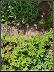
At Indian Creek we were right at the base of Indian Head Peak. One tent was at the pass. A solo hiker heading north passed us. There was a great flower display on our early September trip in 2011. There was not much left at the end of July this year. As we started to climb out of the pass we did see columbine and monkshood in bloom. Columbine I have been seeing nearly every week. Monkshood is seen much less often. The trail climbed moderately by steadily as we contoured around Indian Head Peak. It is a big peak and it took a lot of time. We were now to the east of the peak with views to the south at first and then to the west. Strangely, John noticed bleeding hearts still blooming. I first saw them in mid April this spring. We saw a few tiger lilies, Indian paintbrush, and asters along here. Most asters seen on the trip were beyond peak. These ones were perfect. After passing Indian Head Peak the trail returned to the crest. Sometimes we had views east, sometimes west, and sometimes none while hiking in forest.
We passed a pond and a slightly larger tarn and even a little remaining snow on the trail. White Mountain came back into view with 1.6 miles to go. This last part seemed to take forever. As we came closer views of Foam Basin came into closer view. That would be part of our loop trip the next day. The slope of the basin looked to be about 80 degrees steep. It is not. We reached White Pass at 5:03 pm. One last 150' drop took us to the camping area. We saw several marmots on the way down. There were quite a few tents in sight but we found a good campsite where we just barely fit all three tents in a band of trees. We hoped to avoid as much condensation as possible. We set up our tents and they did mostly dry off before bedtime. Water was plentiful and we filled two bags with enough for two days. By 8:40 pm we were in bed. It was just a few minutes after sunset and not yet dark. The next day we could look forward to hiking with much lighter packs. For the day we hiked 11 miles with 2700' of elevation gain.
 Misty Morning |
 Western Anemone |
 Red & Orange Paintbrush |
 Penstemon |
 In The Mist |
 Valerian |
 Upper Blue Lake |
 High Route |
 Looking Down |
 Nearing Ridge Top |
 Still Cloudy |
 Clearing Up |
 Big Meadow |
 Glacier Peak In Sight |
 View North |
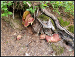 Fungi |
 More Meadows |
 Kodak Peak Ahead |
 North On The PCT |
 Meadow & Kodak Peak |
 Peaks & Meadows |
 Meander Meadows |
 Gary & John |
 Last Break |
 Flower Display |
 Lewis Monkey Flower |
 Monkshood |
 Columbine |
 Another Paintbrush |
 Bleeding Hearts |
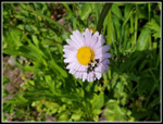 Aster & Beetle |
 North Side Of IH Peak |
 Snow Patch |
 Lupine |
 Tuesday Summit |
 John & False Hellebore |
 View South |
 Nearing White Pass |
 White Pass Campsite |
 Sunday Sunset |
<< Day >>
Pilot Ridge - NF Sauk Loop Report
Home