5-18-19
I
hiked up South Bessemer Mt. in
2003,
2004,
and 2007. All trips had snow on the upper mountain. I had
not been back in 12 years. The route is a road walk. A long one with a
lot of elevation gain. make that 13 miles round trip with 4100' of
gain. On my first trip I forgot my map and wound my way to the summit
on snowshoes cross country near the top. I came back a year later,
again with a lot of snow up high, and took the road route all the way.
Three years after that I made my last visit. Suzanne and I summited and
had rain much of the way down. Only one of those three trips had clear
sky and views. This day looked to be partly cloudy but with some good
views. It is also a pretty lonely place. Not many folks know of it or
like the idea of 4100' of gain on a road. Along with solitude it
provides really good summit views.
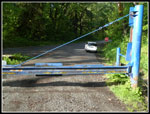
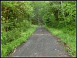
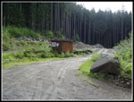
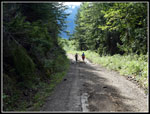
There is not much parking so I left early to snag a spot. On all my other visits I had to negotiate the really bad MF Road. Now it is paved and that cuts off a lot of time going 15 mph dodging all the pot holes. I was on the road from North Seattle at 7:05 am. I arrived at the gate at 8:00 am. The gate is 2 miles after the big bridge over the river. I was the first car to arrive. Two walkers started up the road about five minutes before me. I was on the road/trail at 8:05 am. What I did remember about the route is it just keeps getting steeper. The first mile up to the CCC road/trail is pretty gentle. I passed the two hikers a little before reaching the CCC. I took a short detour to get a look at Big Blowout Creek. For the first time there is a log across with the top partly flattened for hikers. About 40 years ago I drove my Pinto up to the creek from North Bend. That will not happen again.
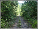
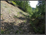
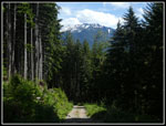
I turned right on the road and looked for the switchback uphill. Twelve years ago the CCC Road continued on past the junction. Now the uphill road is the only road. The CCC is now a trail. The brush is thick enough where it starts to make it hard to see. A short way up the road is the rock quarry. It was not there in 2004 but it was there on my 2007 trip. The road is in excellent shape. It is not overly hard and rocky. It is smooth. I made pretty good time. Before the quarry I had to stop to zip off pants legs and put on a short sleeve shirt. The day was warming rapidly.
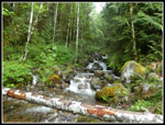
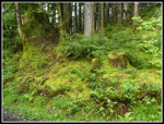
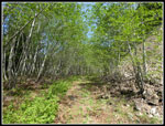
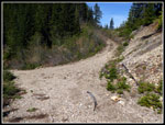
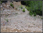
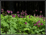
There are a few wildflowers along the road but it is not a very extensive display. I did see several very large patches of bleeding hearts. There were some buttercups, salmonberry, and trillium too. The road crosses a creek three times. On my first two visits the first two were rock hops. The road has been improved since then and that includes new culverts. There are now no creek crossings. As I climbed I saw two runners coming down. They did not go up South Bessemer so I have no idea where they did go. Per my 2003 trip report, at about 4 1/3 miles is where the road switches back to the right. Back then the road straight ahead and the switchback were about equal in size. No longer. The road straight ahead is in use and well maintained. The correct road is much smaller and rockier. My map showed the correct road and I had no trouble finding it. The road is now much steeper and much rockier. Brush is starting to fill in but there is no bushwhacking yet. All the small trees growing in the middle of the old road will become a problem in a few more years.
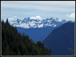
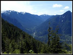
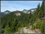
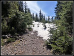
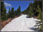
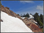
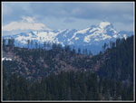
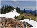
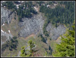
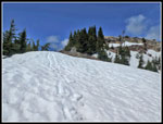
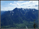
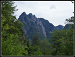
On my previous visits I started seeing snow not far above here. Under snow all the rocks are covered. This day that was not the case. The rocky parts got better higher up. A short distance below the junction with the spur to the saddle is an open spot with some really great views. Across the valley to Russian Butte and Middle Fork peaks. Below is a good view of the Pratt River Valley. I stopped to slather on sunscreen. I soon reached the side road left up to the saddle. On my first trip without the map I went that way and took a cross country route to the summit. It was shorter but not easier. I don't plan to do that again. I went right. I had seen a small snow patch just below. As the road climbed I met the first big patch. There were a few more patches and open spots before the snow became continuous.
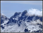
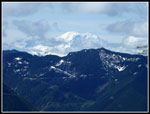
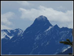
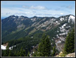
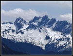
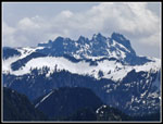
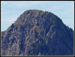
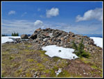
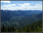
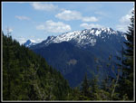
It was hard enough that I did not sink far. I did not bother putting on gaiters. The road swung around to the west and the snow was deeper. The road held the snow. On the slope above it there was more bare ground. I slogged along to the next junction. Staying left is the correct choice. Now I turned to the northwest and climbed towards the summit. From this elevation the views were really good. I had seen Green Mountain for quite a while but now the top of Mt. Teneriffe came into view. The last bit of road to the summit ridge had a steep snow cover across it. The snow was soft enough to kick steps across. The real summit is the far point. I stopped at the first high point. It was snow free. The real summit was all under snow. I went up to the top of the rocks and sat down. Only the real summit some 25' or so higher blocked my view. I had almost a full 360 degree viewpoint.
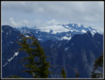
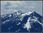
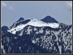
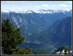
Time for lunch and a long stay. It was 11:17 when I arrived. 3:12 was not a great time but not too bad either. There were some clouds but only Mt. Rainier was in the clouds. I had seen it earlier. Mt. Baker was partly cloudy. The Cascade Crest peaks still have a lot of snow on them. The north side of peaks along I-90 do too. I just sat back and soaked in the views. I was very surprised to have an unobstructed view of Downtown Seattle. With my 30x zoom point and shoot camera I could get a reasonably good photo. On the way up I saw those four people. I spent 1:26 on top with total solitude. Very unlike, Si, Teneriffe, and Mailbox Peaks nearby. At 12:43 I packed up and headed down.
Hiking down the snowy road was much faster. It softened up and in the deeper spots I sank below the tops of my boots. Not worth stopping to put on gaiters. I had some damp socks for a while. Soon I was off the snow. As I dropped towards the saddle junction I saw a hiker going up that spur. When I passed the junction I could hear two hikers talking up at the saddle. Down at the good viewpoint I met the fifth person of the day. She was with the two at the saddle. She had knee surgery earlier in the year and was going to stop at the viewpoint. Not long after I met two more hikers coming up. They were the last folks seen all day. Not bad. I was happy to get down to the good road. The rest of the way was easier on my knees.
That 4 1/3 miles went by fast enough. Still, 6 1/2 miles down losing 4100' of elevation is a bit of a knee pounder. I was glad to reach the CCC Road section where the grade eased greatly. I made it back to the gate at 3:13 pm. I took 2:30 coming down. There is not much room to park before the gate Several cars were parked right on the fog line along the road. All but one spot were taken.
This was a fun hike. The weather was great. It was 70 degrees at the bottom. I was out in the sun most of the upper road and summit but heat was not a problem. There was enough snow to add to the scenery without adding much too much difficulty. I especially like spring visits when the surrounding peaks still have a layer of snow. It is a road walk. A long one at that. This is not a trip for the hike as much as for the summit views. As such it is not on my short list of often hiked peaks. It will stay on my less visited list as a fun trip to do every so often.
Click on thumbnails to get
larger pictures.
Trips - 2019
Home
There is not much parking so I left early to snag a spot. On all my other visits I had to negotiate the really bad MF Road. Now it is paved and that cuts off a lot of time going 15 mph dodging all the pot holes. I was on the road from North Seattle at 7:05 am. I arrived at the gate at 8:00 am. The gate is 2 miles after the big bridge over the river. I was the first car to arrive. Two walkers started up the road about five minutes before me. I was on the road/trail at 8:05 am. What I did remember about the route is it just keeps getting steeper. The first mile up to the CCC road/trail is pretty gentle. I passed the two hikers a little before reaching the CCC. I took a short detour to get a look at Big Blowout Creek. For the first time there is a log across with the top partly flattened for hikers. About 40 years ago I drove my Pinto up to the creek from North Bend. That will not happen again.
I turned right on the road and looked for the switchback uphill. Twelve years ago the CCC Road continued on past the junction. Now the uphill road is the only road. The CCC is now a trail. The brush is thick enough where it starts to make it hard to see. A short way up the road is the rock quarry. It was not there in 2004 but it was there on my 2007 trip. The road is in excellent shape. It is not overly hard and rocky. It is smooth. I made pretty good time. Before the quarry I had to stop to zip off pants legs and put on a short sleeve shirt. The day was warming rapidly.
There are a few wildflowers along the road but it is not a very extensive display. I did see several very large patches of bleeding hearts. There were some buttercups, salmonberry, and trillium too. The road crosses a creek three times. On my first two visits the first two were rock hops. The road has been improved since then and that includes new culverts. There are now no creek crossings. As I climbed I saw two runners coming down. They did not go up South Bessemer so I have no idea where they did go. Per my 2003 trip report, at about 4 1/3 miles is where the road switches back to the right. Back then the road straight ahead and the switchback were about equal in size. No longer. The road straight ahead is in use and well maintained. The correct road is much smaller and rockier. My map showed the correct road and I had no trouble finding it. The road is now much steeper and much rockier. Brush is starting to fill in but there is no bushwhacking yet. All the small trees growing in the middle of the old road will become a problem in a few more years.
On my previous visits I started seeing snow not far above here. Under snow all the rocks are covered. This day that was not the case. The rocky parts got better higher up. A short distance below the junction with the spur to the saddle is an open spot with some really great views. Across the valley to Russian Butte and Middle Fork peaks. Below is a good view of the Pratt River Valley. I stopped to slather on sunscreen. I soon reached the side road left up to the saddle. On my first trip without the map I went that way and took a cross country route to the summit. It was shorter but not easier. I don't plan to do that again. I went right. I had seen a small snow patch just below. As the road climbed I met the first big patch. There were a few more patches and open spots before the snow became continuous.
It was hard enough that I did not sink far. I did not bother putting on gaiters. The road swung around to the west and the snow was deeper. The road held the snow. On the slope above it there was more bare ground. I slogged along to the next junction. Staying left is the correct choice. Now I turned to the northwest and climbed towards the summit. From this elevation the views were really good. I had seen Green Mountain for quite a while but now the top of Mt. Teneriffe came into view. The last bit of road to the summit ridge had a steep snow cover across it. The snow was soft enough to kick steps across. The real summit is the far point. I stopped at the first high point. It was snow free. The real summit was all under snow. I went up to the top of the rocks and sat down. Only the real summit some 25' or so higher blocked my view. I had almost a full 360 degree viewpoint.
Time for lunch and a long stay. It was 11:17 when I arrived. 3:12 was not a great time but not too bad either. There were some clouds but only Mt. Rainier was in the clouds. I had seen it earlier. Mt. Baker was partly cloudy. The Cascade Crest peaks still have a lot of snow on them. The north side of peaks along I-90 do too. I just sat back and soaked in the views. I was very surprised to have an unobstructed view of Downtown Seattle. With my 30x zoom point and shoot camera I could get a reasonably good photo. On the way up I saw those four people. I spent 1:26 on top with total solitude. Very unlike, Si, Teneriffe, and Mailbox Peaks nearby. At 12:43 I packed up and headed down.
Hiking down the snowy road was much faster. It softened up and in the deeper spots I sank below the tops of my boots. Not worth stopping to put on gaiters. I had some damp socks for a while. Soon I was off the snow. As I dropped towards the saddle junction I saw a hiker going up that spur. When I passed the junction I could hear two hikers talking up at the saddle. Down at the good viewpoint I met the fifth person of the day. She was with the two at the saddle. She had knee surgery earlier in the year and was going to stop at the viewpoint. Not long after I met two more hikers coming up. They were the last folks seen all day. Not bad. I was happy to get down to the good road. The rest of the way was easier on my knees.
That 4 1/3 miles went by fast enough. Still, 6 1/2 miles down losing 4100' of elevation is a bit of a knee pounder. I was glad to reach the CCC Road section where the grade eased greatly. I made it back to the gate at 3:13 pm. I took 2:30 coming down. There is not much room to park before the gate Several cars were parked right on the fog line along the road. All but one spot were taken.
This was a fun hike. The weather was great. It was 70 degrees at the bottom. I was out in the sun most of the upper road and summit but heat was not a problem. There was enough snow to add to the scenery without adding much too much difficulty. I especially like spring visits when the surrounding peaks still have a layer of snow. It is a road walk. A long one at that. This is not a trip for the hike as much as for the summit views. As such it is not on my short list of often hiked peaks. It will stay on my less visited list as a fun trip to do every so often.
 Small Parking Area |
 Catching Up |
 Big Blowout Creek |
 Very Green |
 Rock Quarry |
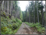 Smooth Road |
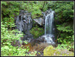 Small Falls |
 Bigger Falls |
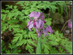 Bleeding Hears |
 Two Runners |
 Onto Upper Road |
 Leaf Canopy |
 Very Rocky Spot |
 First Snowy Peaks View |
 Viewpoint |
 Pratt River Valley |
 Saddle Junction |
 View West |
 First Solid Snow |
 Mt. Rainier |
 Mt. Thomson |
 Continuous Snow |
 View Down Ridge |
 Summit Just Ahead |
 Mt. Baker |
 Chimney Rock Area |
 Mts. Hinman & Daniel |
 More Peaks |
 Lower Summit |
 Mt. Teneriffe |
 Granite Mountain |
 More Peaks |
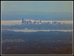 Downtown Seattle |
 Waterfall |
 Lower Summit Rocks |
 Upper MF Valley |
 Starting Down |
 Lower MF Valley |
 Lower Viewpoint |
 Russian Butte |
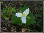 Trillium |
 Road Junction |
 Lots Of Bleeding Hearts |
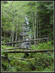
 Forest View |
 Almost Done |
Trips - 2019
Home